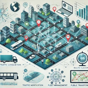
GIS for Transportation: A Comprehensive Overview
Geographic Information Systems (GIS) have become indispensable in transportation
for enhancing planning, management, and decision-making. By allowing
the integration and visualization of spatial data, GIS offers a detailed perspective on tran
sportation networks and infrastructure. The result is increased efficiency, safety, and sustainability across the board. From optimizing routes to analysing traffic, GIS plays a vital role in transforming the transportation sector.
Real-World Applications of GIS in Transportation
GIS is versatile and can be applied in many transportation scenarios:
- Route Planning & Optimization: GIS identifies the most efficient routes by analysing traffic, road conditions, and distance. For instance, Google Maps and Waze leverage GIS to provide real-time traffic updates and optimal routes. Transportation companies use it to reduce fuel consumption and travel time.
Example: In logistics, delivery services like UPS employ GIS to manage routes, reducing delivery times and costs by up to 10%.
- Traffic Management: Cities use GIS to monitor traffic flows and identify congestion points. This can be seen in how New York City employs GIS to analyze accident hotspots and redesign traffic patterns.
- Public Transport Optimization: Transit authorities use GIS to adjust routes and schedules based on passenger data. For example, London’s TfL uses GIS for managing bus and underground schedules, responding to real-time demand changes.
- Fleet Management: Businesses with large vehicle fleets utilize GIS to track and manage routes in real-time. FedEx, for instance, uses GIS to optimize delivery routes for its fleet.
For more on how companies like UPS and FedEx use GIS, visit [FedEx’s Innovation & Technology Page](https://www.fedex.com/en-us/about/innovation.html).
Case Study: Improving City Traffic with GIS
An excellent example of GIS in action is Los Angeles implementing a GIS-based transportation system. The city uses traffic pattern data (e.g., accidents, speed limits, volume) to adjust signal timings and enhance road safety. The outcome has been a noticeable reduction in traffic congestion and travel times.
For further reading, explore LA’s traffic management case study at [LA’s Transportation Department Website](https://ladot.lacity.org/).
Challenges and Considerations
While GIS offers enormous potential, several hurdles must be addressed:
Data Quality: High-quality, real-time data is essential for effective GIS analysis. Outdated or incorrect data can lead to inefficient solutions.
Integration with Existing Tools: GIS often needs to integrate with transportation modeling tools. Ensuring compatibility across platforms can be complex.
Resource Intensity: Implementing a GIS-based system involves significant financial and human resources, often necessitating trained personnel and continuous updates.
For more challenges in GIS implementation, see [Esri’s Best Practices for GIS in Transportation](https://www.esri.com/en-us/industries/transportation/overview).
The Future of GIS in Transportation
The future of GIS looks promising, with new technologies unlocking more potential:
Autonomous Vehicles: GIS will be vital for the navigation systems of self-driving cars. Waymo uses detailed GIS maps for route navigation.
AI Integration: Combining GIS with Artificial Intelligence (AI) can lead to real-time analysis of vast data sets. AI-powered GIS tools could instantly adjust transport routes based on accidents or construction updates.
Sustainability Efforts: Cities like Copenhagen use GIS to support sustainable transport initiatives, reducing emissions and promoting public transport and cycling.
For more on the future of GIS and AI integration, check out [Esri’s AI & GIS](https://www.esri.com/en-us/arcgis/products/arcgis-ai/overview).
GIS has already transformed transportation planning, management, and optimization. From cutting-edge fleet management systems to city-wide traffic monitoring, GIS helps organizations and cities operate more efficiently. As technology evolves, so too will the applications of GIS, bringing even greater improvements to the future of transportation.


