The Role of GIS in Transportation

Applications of GIS in Transportation
-
Route Planning and Optimization
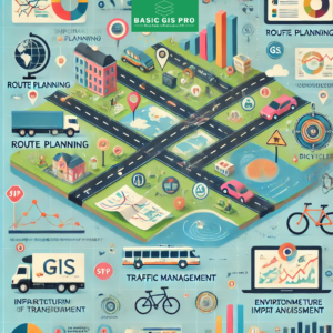
- GIS facilitates network analysis to identify the most efficient transportation routes, considering factors like distance, traffic conditions, and road characteristics. Companies leverage these capabilities to optimize logistics, reducing fuel consumption and enhancing service efficiency.
-
Infrastructure Management
- GIS aids in asset management by enabling the tracking and maintenance of transportation infrastructure, including roads, bridges, and railways. Condition monitoring through GIS tools allows for timely repairs and proactive maintenance scheduling.
-
Traffic Management and Monitoring
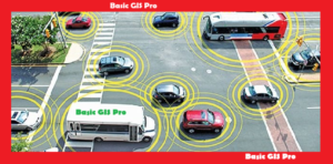
- By analyzing traffic flow, GIS identifies congestion hotspots and supports effective traffic management strategies. Integration with real-time data sources, such as traffic cameras and sensors, allows for dynamic monitoring of traffic conditions.
-
Planning and Policy Development
- GIS supports urban and regional transportation planning by evaluating the impacts of new projects, assessing land use patterns, and developing sustainable transportation policies. Public transit planning is enhanced through the analysis of service areas and routes.
-
Environmental Impact Assessment
- GIS assists in evaluating the environmental implications of transportation projects, helping to design systems that minimize ecological disruption and promote sustainability through impact modeling.
-
Emergency Response and Management
- GIS plays a critical role in planning for emergencies by aiding in the development of evacuation routes and enhancing incident management for natural disasters or accidents.
-
Data Integration and Visualization
- GIS provides a platform for integrating diverse datasets—such as demographic, land use, and infrastructure data—into cohesive maps, facilitating better decision-making among stakeholders.
-
Pedestrian and Bicycle Planning
- GIS is instrumental in assessing the accessibility of transportation networks for non-motorized users. It helps identify safe routes and necessary infrastructure improvements for pedestrians and cyclists.
-
Intelligent Transportation Systems (ITS)
- GIS can be integrated with ITS technologies to improve traffic management, deliver real-time updates, and enhance transportation efficiency.
Essential Requirements for Implementing GIS in Transportation
To effectively utilize GIS in the transportation sector, several essential requirements must be met:
-
Geospatial Data
- Accurate and Comprehensive Data: High-quality geospatial data is fundamental for GIS applications. This includes road networks, traffic volumes, accident data, land use, environmental conditions, and socio-economic factors. Datasets should be regularly updated to reflect current conditions.
- Spatial Data Infrastructure (SDI): Establishing an SDI can streamline data sharing and accessibility among various agencies and stakeholders, ensuring that data is readily available for analysis.
-
GIS Software
- Robust GIS Software: Choosing the right GIS software is crucial for processing and analyzing spatial data. Software options include ESRI ArcGIS, QGIS, and others, each offering unique capabilities tailored to different needs.
- Integration Capabilities: The GIS software should support integration with other systems, such as traffic management systems, databases, and real-time data sources.
-
User Training and Capacity Building
- Training Programs: Users must be trained to effectively utilize GIS tools and interpret spatial data. This includes understanding GIS principles, data management, and analytical techniques.
- Capacity Building: Ongoing capacity building ensures that transportation professionals can adapt to evolving GIS technologies and methodologies.
-
Technical Infrastructure
- Hardware Requirements: Adequate hardware infrastructure is essential for running GIS applications efficiently. This includes computers with sufficient processing power, memory, and storage capacity to handle large datasets.
- Network Connectivity: Reliable internet access is necessary for cloud-based GIS applications, real-time data integration, and collaborative efforts among stakeholders.
-
Collaboration and Stakeholder Engagement
- Interagency Collaboration: Effective GIS implementation requires collaboration among various agencies, including transportation departments, urban planners, environmental organizations, and emergency management entities.
- Public Engagement: Engaging the public and stakeholders in the planning process through GIS can improve transparency and foster community support for transportation projects.
The integration of GIS in the transportation sector enhances decision-making processes and improves the efficiency and sustainability of transportation systems. By leveraging accurate geospatial data, robust software, and collaborative efforts among stakeholders, transportation professionals can create more effective and responsive transportation solutions. GIS is not just a tool; it’s a critical component for building the future of transportation.


